Mokrojelanchyk
Amvrosiivka
Impact area
Launching
area
Ukraine
Russia
Crater field
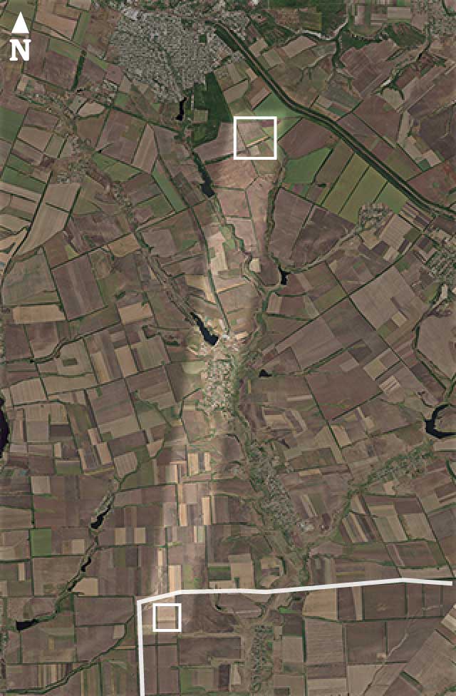
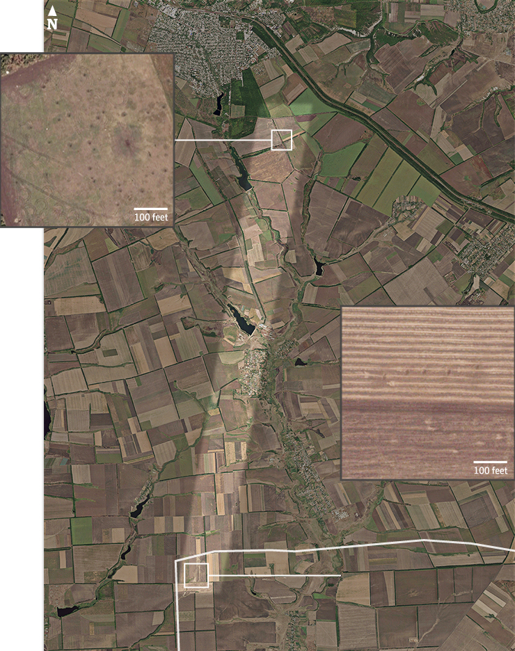
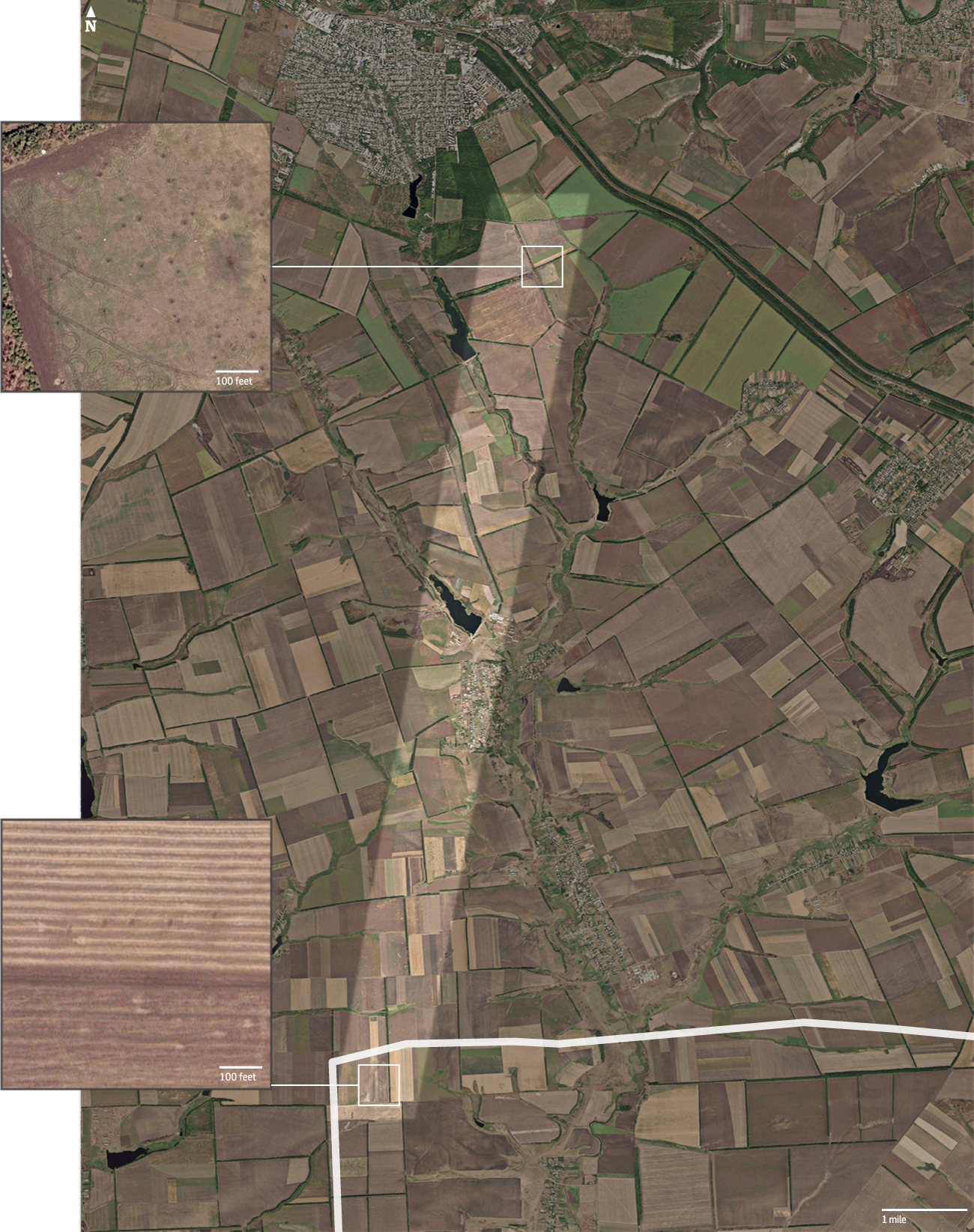
Using satellite imagery dated 16 July 2014, Bellingcat analysed the shapes of 330 visible craters to trace an average trajectory to a site 14.6km across the border near the Russian village of Seleznev.
Suspected launch site
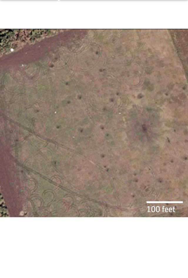
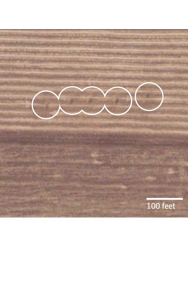
The satellite imagery shows five regularly spaced burn marks on the ground, which Bellingcat say are characteristic of scorching caused by multiple rocket launcher systems. Also visible at the site were tracks leading further into Russia which match the width and turning radii of such vehicles.
Mokrojelanchyk
Amvrosiivka
Suspected launch site
The satellite imagery shows five regularly spaced burn marks on the ground, which Bellingcat say are characteristic of scorching caused by multiple rocket launcher systems. Also visible at the site were tracks leading further into Russia which match the width and turning radii of such vehicles.
Crater field
Using satellite imagery dated 16 July 2014, Bellingcat analysed the shapes of 330 visible craters to trace an average trajectory to a site 14.6km across the border near the Russian village of Seleznev.
Ukraine
Russia
Seleznev
Vasylivka
Mokrojelanchyk
Amvrosiivka
Suspected launch site
The satellite imagery shows five regularly spaced burn marks on the ground, which Bellingcat say are characteristic of scorching caused by multiple rocket launcher systems. Also visible at the site were tracks leading further into Russia which match the width and turning radii of such vehicles.
Crater field
Using satellite imagery dated 16 July 2014, Bellingcat analysed the shapes of 330 visible craters to trace an average trajectory to a site 14.6km across the border near the Russian village of Seleznev.
Ukraine
Russia